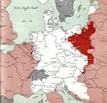
Datei:Map Deutschland 1945-02-01.jpg
Version vom 29. Mai 2017, 06:08 Uhr von Oteriwutaban (Diskussion | Beiträge) (By Army Map Service - Document "Atlas of the World Battle Fronts in Semimonthly Phases to August 15th 1945: Supplement to The Biennial report of the Chief of Staff of the United States Army July 1, 1943 to June 30 1945 To the Secretary of War", Public…)

Größe dieser Vorschau: 625 × 599 Pixel. Weitere Auflösungen: 250 × 240 Pixel | 1.270 × 1.218 Pixel.
Originaldatei (1.270 × 1.218 Pixel, Dateigröße: 1,25 MB, MIME-Typ: image/jpeg)
By Army Map Service - Document "Atlas of the World Battle Fronts in Semimonthly Phases to August 15th 1945: Supplement to The Biennial report of the Chief of Staff of the United States Army July 1, 1943 to June 30 1945 To the Secretary of War", Public Domain, https://commons.wikimedia.org/w/index.php?curid=3271960
Dateiversionen
Klicke auf einen Zeitpunkt, um diese Version zu laden.
| Version vom | Vorschaubild | Maße | Benutzer | Kommentar | |
|---|---|---|---|---|---|
| aktuell | 06:08, 29. Mai 2017 |  | 1.270 × 1.218 (1,25 MB) | Oteriwutaban (Diskussion | Beiträge) | By Army Map Service - Document "Atlas of the World Battle Fronts in Semimonthly Phases to August 15th 1945: Supplement to The Biennial report of the Chief of Staff of the United States Army July 1, 1943 to June 30 1945 To the Secretary of War", Public… |
- Du kannst diese Datei nicht überschreiben.
Dateiverwendung
Die folgende Seite verwendet diese Datei: